
I hiked Boulder River Trail last summer and understood why people call it a hidden gem. You want solid information before making the drive – I’ve got you covered.
This guide covers trail facts, waterfall locations, parking details, camping spots, and when to visit. I’ve hiked this trail in different seasons and know what works.
You’ll get clear directions, honest difficulty ratings, trail length, terrain details, and where to find all three waterfalls.
I’ll cover parking rules, best hiking seasons, camping options, and safety basics. Let’s make your Boulder River Trail hike smooth and memorable.
Boulder River Trail Overview
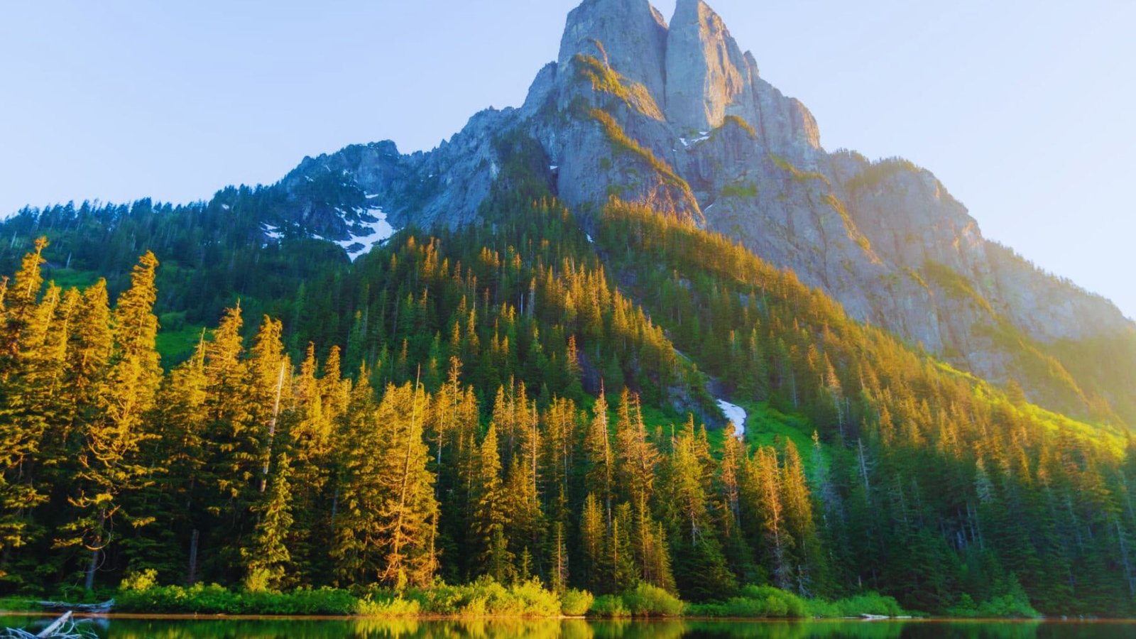
Boulder River Trail sits in the North Cascades, about 60 miles northeast of Arlington, Washington. The trail follows Boulder River through old-growth forest and passes three waterfalls along the way.
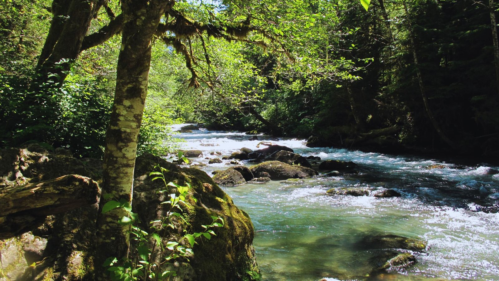
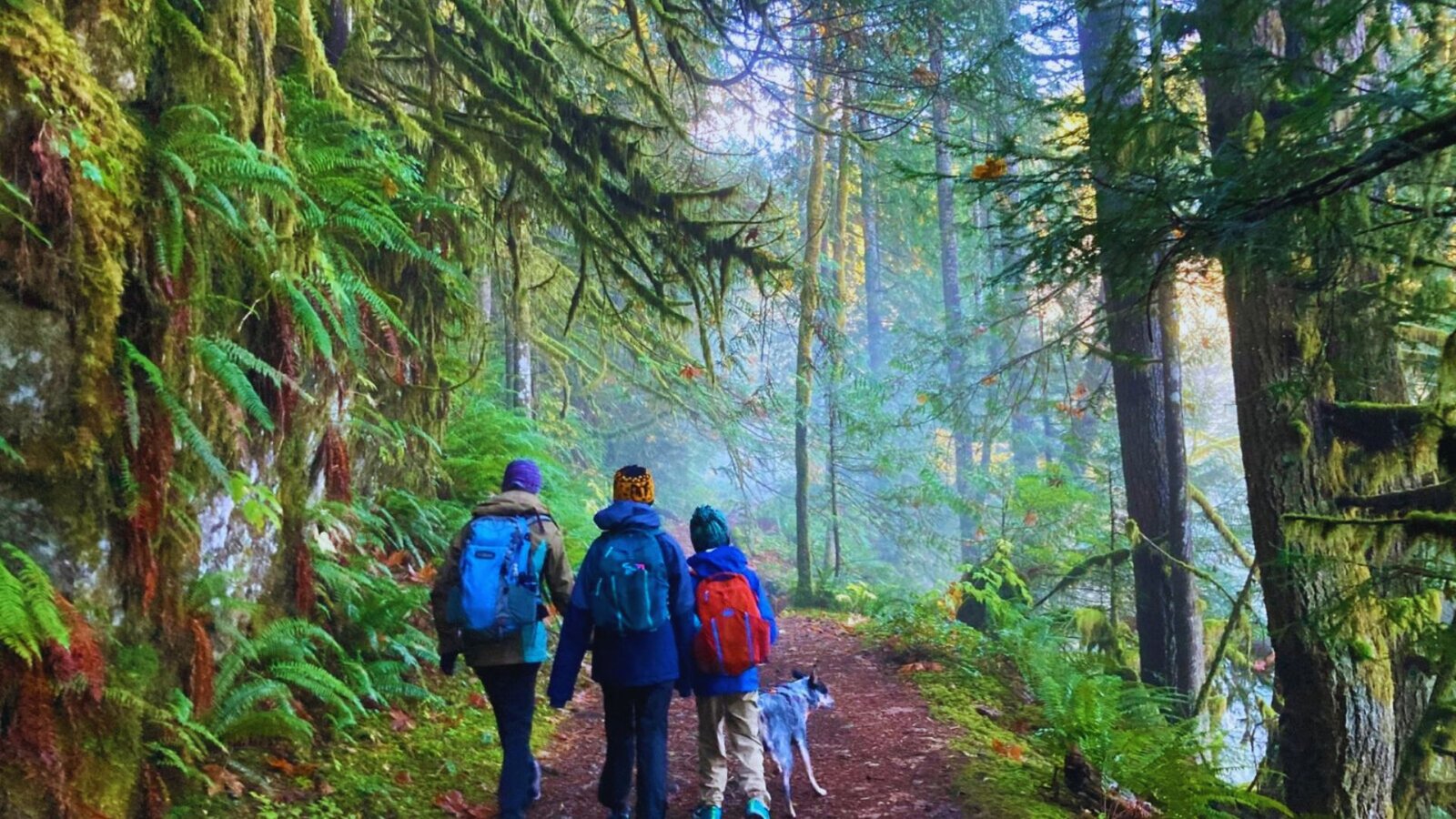
Hikers love this trail because it stays relatively flat, offers shade on hot days, and rewards you with waterfall views without brutal climbs. The forest here feels ancient and peaceful. Moss covers everything. The river runs clear and cold beside you for most of the hike.
Boulder River Trail Hiking Experience
The experience on Boulder River Trail combines forest walking, river sounds, and waterfall hunting throughout your hike.
Trail Surface and Terrain Conditions
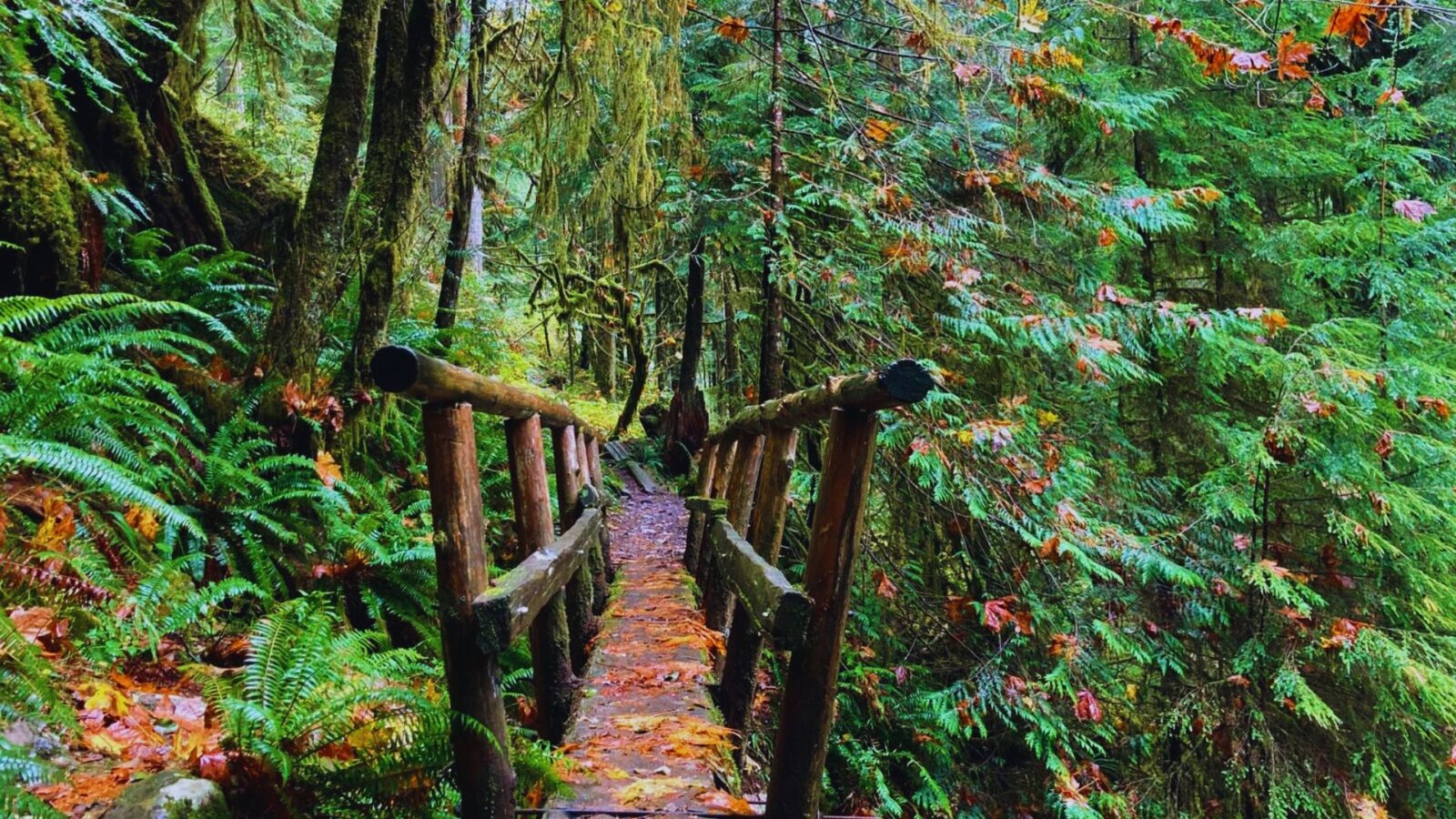
The trail surface is packed with dirt and rock for most of the route. You’ll cross several wooden bridges over small creeks. Some sections have exposed tree roots.
A few spots get muddy after rain. The trail stays wide enough for comfortable walking. No scrambling or rock climbing required.
Forest River and Old Growth Scenery
The old-growth forest here is the real star. Cedar and Douglas fir trees tower above you. Some are hundreds of years old. The Boulder River runs alongside the trail for long stretches.
The sound of rushing water follows you. Moss hangs from branches. Ferns cover the forest floor.
What Makes Boulder River Trail Special
Three waterfalls in one hike make this trail stand out. The old-growth forest creates a different mood than newer forests.
The trail doesn’t get as crowded as other North Cascades hikes. You get waterfall payoffs without steep, punishing climbs.
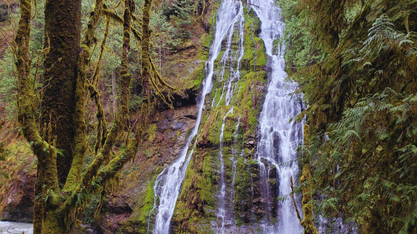
Boulder River Trail Waterfalls
Three waterfalls reward hikers on Boulder River Trail, each with its own character and viewing spot.
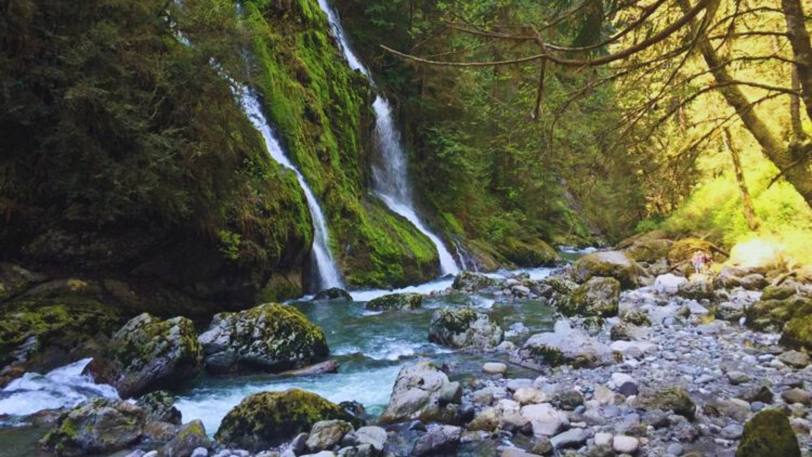
Pre Show Falls on Boulder River Trail
Pre Show Falls appears about 2 miles in. It’s the smallest of the three waterfalls. You’ll see it from the trail without needing to detour.
Some hikers miss it if they’re not watching for it. It cascades down rocks on the right side.
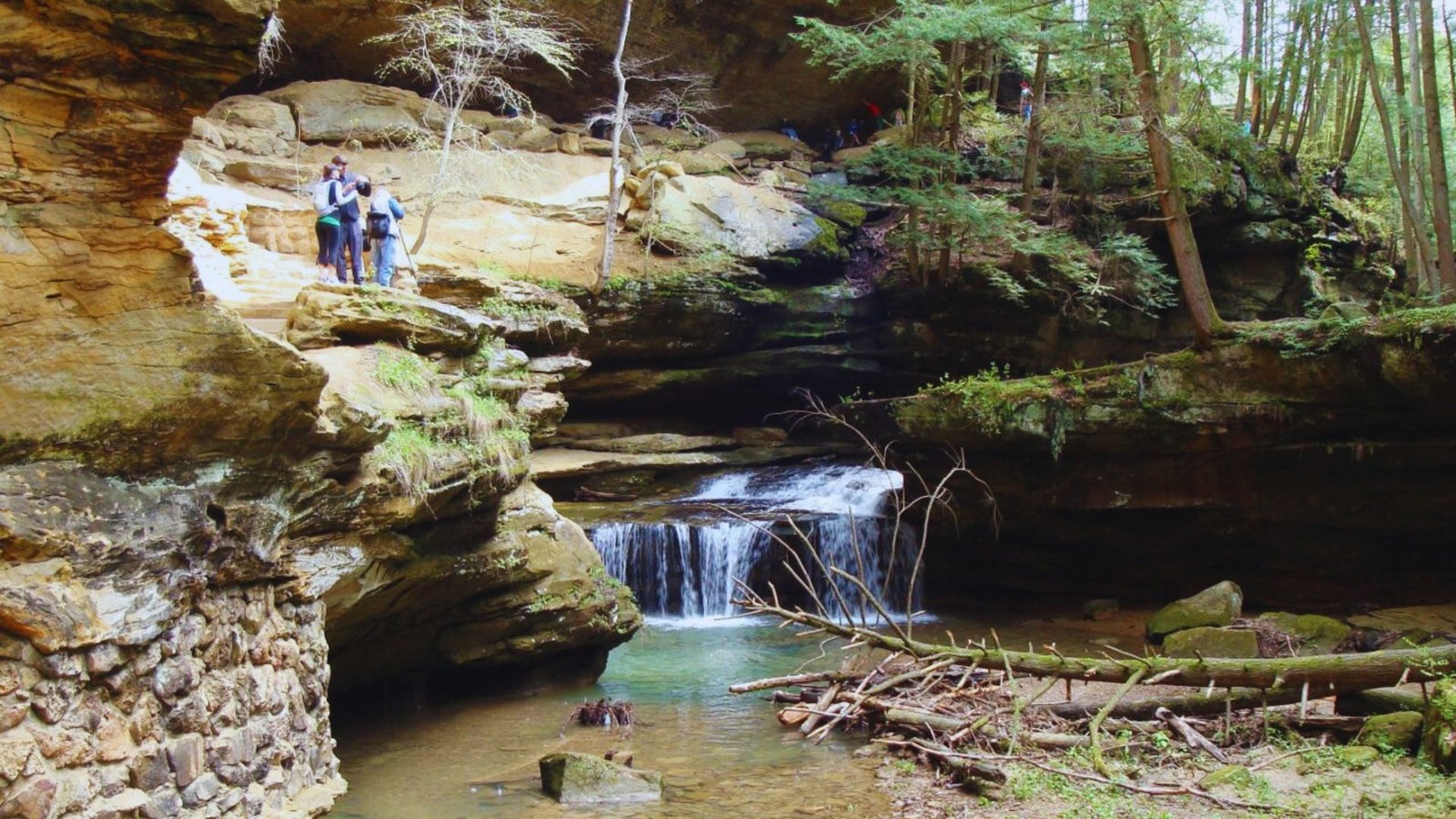
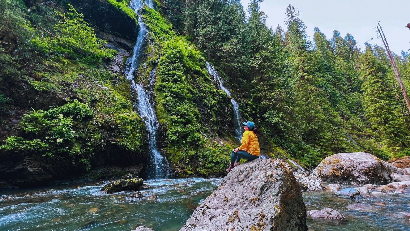
Feature Show Falls Waterfall Viewpoint
Feature Show Falls is the main attraction, located around 3.5 miles in. This is the biggest and most impressive waterfall.
A short spur trail leads to the viewpoint. The falls drop dramatically over a rock face. This is where most hikers stop for lunch and photos.
Meditation Falls Near the Trail End
Meditation Falls sits near the 4.3-mile mark, close to the trail’s end. It’s smaller than Feature Show Falls but worth seeing.
The viewing area here is peaceful. The name fits the quiet atmosphere.
Best Time to See Boulder River Trail Waterfalls
Spring and early summer offer the biggest water flow. Snowmelt feeds these waterfalls in May and June. They’re still flowing in fall but with less volume.
By late summer, some years see reduced flow. Visit after rain for fuller waterfalls any time of year.
Boulder River Trail Map and Route Details
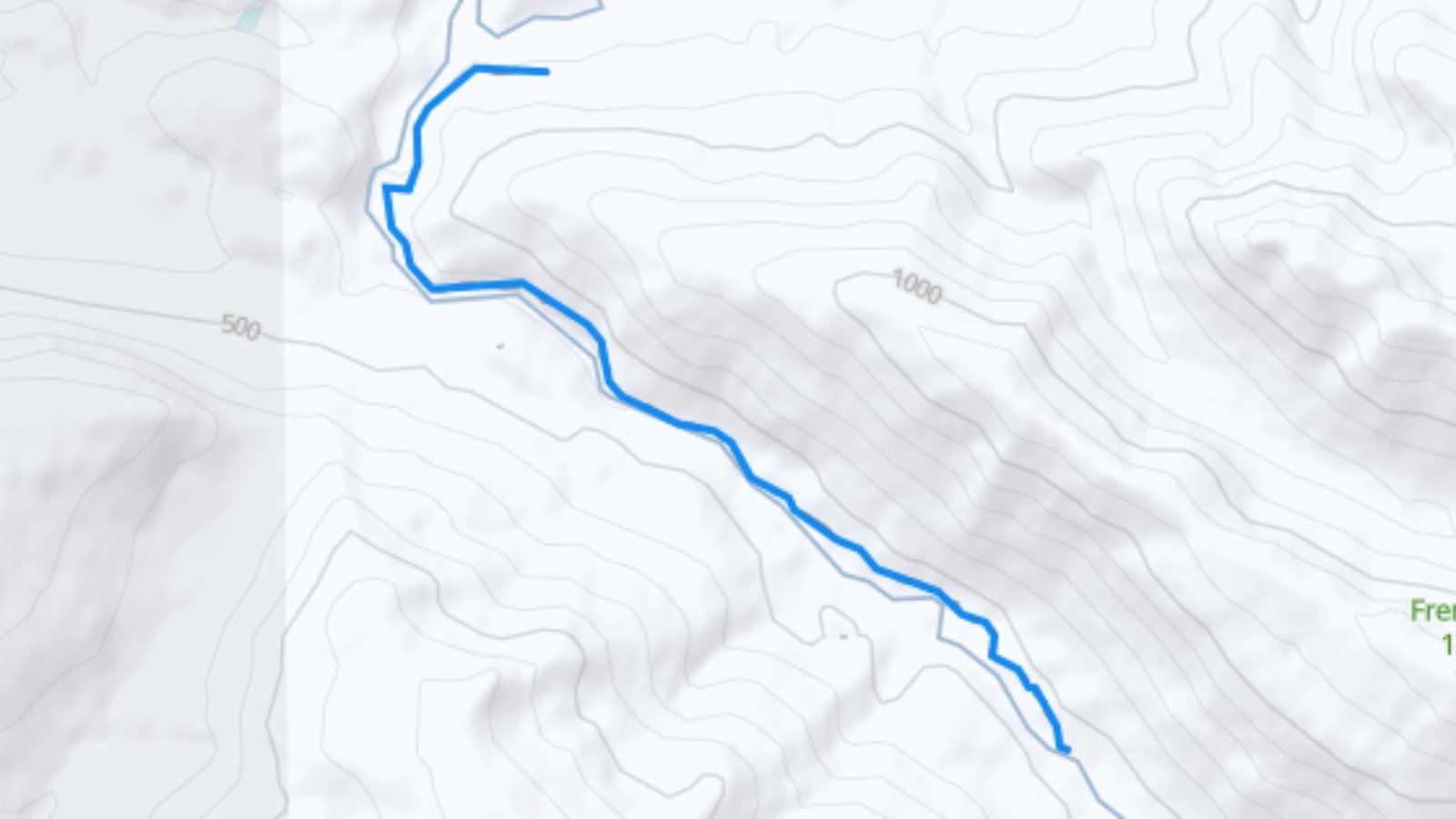
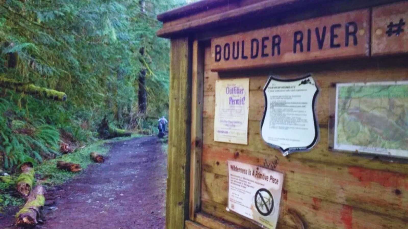
The trailhead is at the end of Forest Road 2010 with a small parking area, trail sign, and pit toilets. From Arlington, take State Route 530 east toward Darrington, then turn right on Forest Road 2010 (Boulder River Road) and drive 4 miles on rough gravel road to reach the trailhead.
High-clearance vehicles work best, but regular cars can make it with slow, careful driving. The trail is well-marked and follows the river.
Download offline maps on AllTrails before leaving, as cell service ends past the highway. Paper maps are available at the ranger station.
Boulder River Trail Parking Information
Parking at Boulder River Trail fills up on nice weekends, so plan accordingly for smooth trail access.
Where to Park for Boulder River Trail
Park at the trailhead lot at the end of Forest Road 2010. The lot holds about 20-25 cars. There’s no overflow parking nearby. If the lot is full, you’ll need to come back another time or arrive earlier.
Parking Conditions and Capacity
The parking area is unpaved gravel. It gets muddy when wet. The lot fills by mid-morning on summer and fall weekends. Weekdays see lighter crowds. Arrive before 8 AM on weekends for guaranteed parking.
Pass Requirements for Boulder River Trail Parking
You need a Northwest Forest Pass to park here. Daily passes cost $5. Annual passes cost $30. Rangers check and ticket cars without passes. Buy passes online, at ranger stations, or some outdoor stores before you arrive.
Best Time to Hike Boulder River Trail
Timing your visit right makes a big difference in your Boulder River Trail experience and trail conditions.
Summer and Fall Hiking Season
Summer (July-September) offers the most reliable weather and dry trail conditions. The forest stays cool even on hot days.
Fall (October-November) brings strong fall colors and fewer bugs. Both seasons work great for this trail.
Winter and Spring Trail Conditions
Winter can bring snow to the trailhead, making road access difficult. The trail itself gets muddy and icy. Spring offers great waterfall flows but expect mud and possible snow patches.
The access road might be impassable until May some years.
Boulder River Trail Camping Information
Overnight options exist on Boulder River Trail for hikers wanting to extend their time in the wilderness.
Established Campsites Along Boulder River Trail
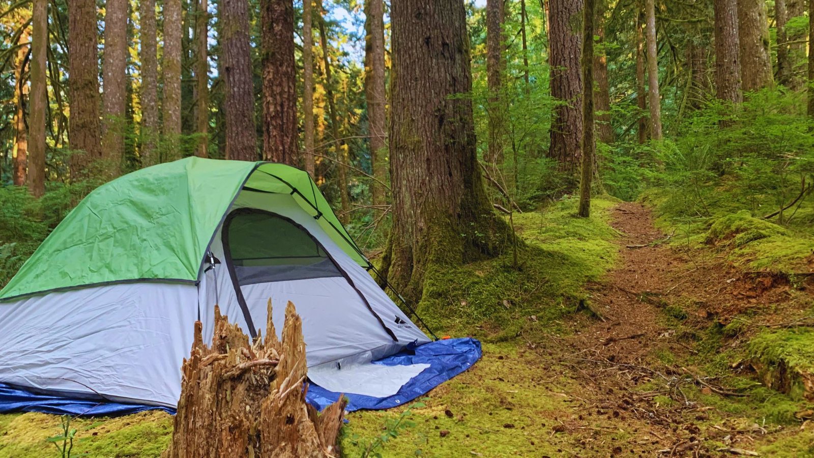
Several primitive campsites sit along the trail past the 3-mile mark. These are designated spots to reduce impact.
The best camping areas are between Feature Show Falls and Meditation Falls. No facilities exist at these sites. Bring everything you need.
Camping Rules and Wilderness Regulations
This is wilderness camping, so follow Leave No Trace principles. Camp at least 200 feet from water. Use established fire rings only. Better yet, use a camp stove instead of fires.
Pack out all the trash. Human waste must be buried 6-8 inches deep, 200 feet from water. A wilderness permit is not required for overnight stays here, but regulations still apply.
Boulder River Trail Quick Facts
Here are the numbers and basics you need to know before planning your Boulder River Trail hike.
Boulder River Trail Distance Elevation and Difficulty
Boulder River Trail runs 8.6 miles round trip. The trail gains about 900 feet in elevation total. Most of that gain happens gradually. The difficulty rating is moderate. Beginners with basic fitness can complete this trail. You’ll walk on mostly flat or gentle uphill sections.
Trail Type and Land Management
This is an out-and-back trail. You hike in on the same path you hike out. The trail sits within Boulder River Wilderness, managed by Mount Baker-Snoqualmie National Forest. Wilderness rules apply here, which means no bikes and pack out all trash.
Is Boulder River Trail Good for Beginners
Yes, this trail works well for beginners. The distance might seem long, but the gentle grade makes it manageable. You can also turn around at any waterfall if 8.6 miles feels like too much. Start early and take breaks when needed.
Safety Tips for Hiking Boulder River Trail
Stay safe on Boulder River Trail by following these basic precautions every time you hike this trail.
- Tell someone your hiking plan and expected return time before leaving home
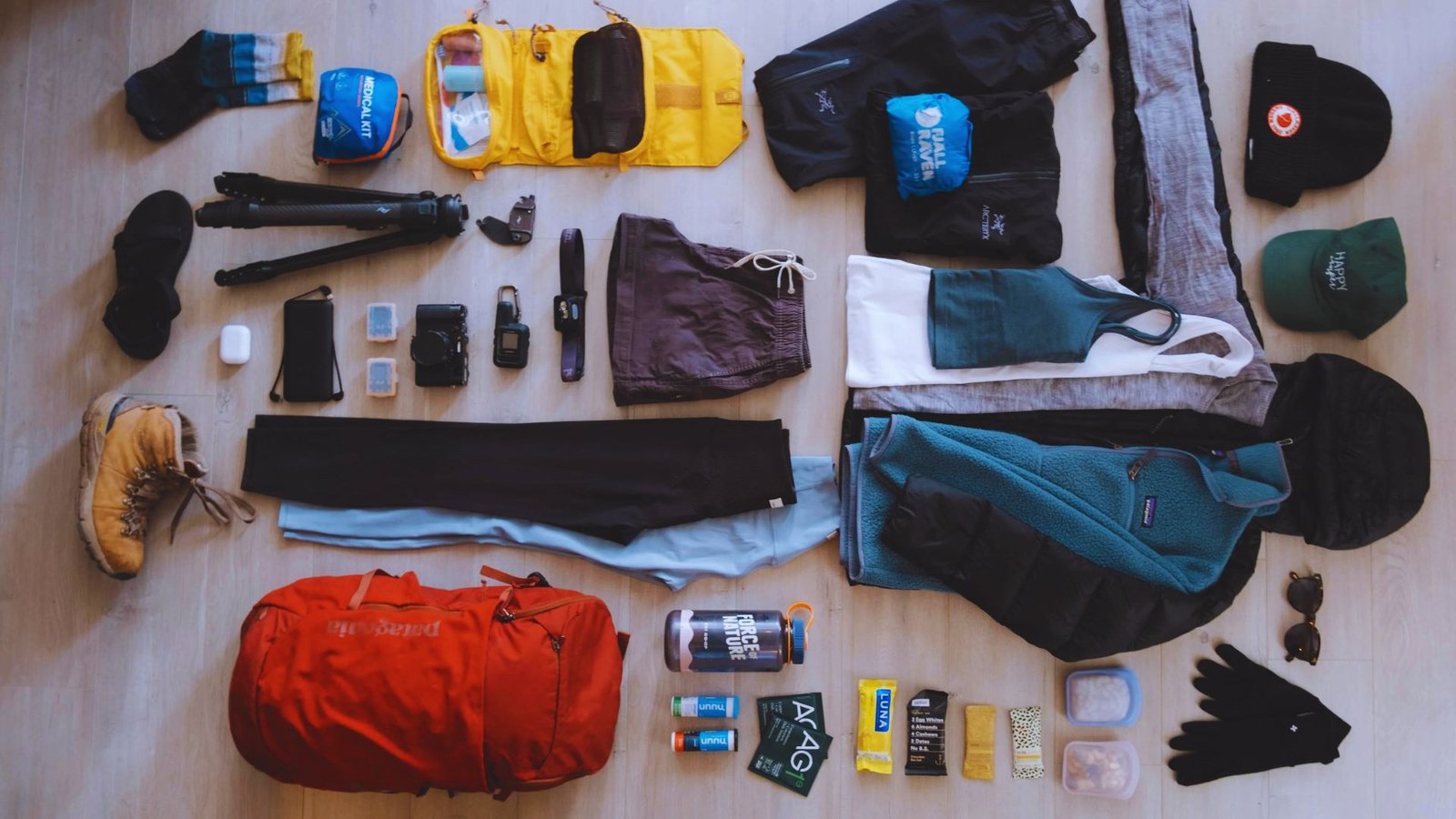
- Bring the ten hiking basics map, water, food, extra layers, first aid, flashlight, fire starter, knife, sun protection, shelter
- Watch for slippery rocks near waterfalls and river crossings on wet days
- Keep food stored away from camp if staying overnight to avoid attracting wildlife
- Turn around if weather turns bad or you feel tired, the trail will be there another day
- Carry enough water for the full hike, the river water needs filtering before drinking
- Stay on marked trails to protect the wilderness and prevent getting lost in the forest
Conclusion
Boulder River Trail gives you waterfalls, old growth, and river views without the crowds found on more famous hikes.
I love how this trail feels remote but stays accessible for most fitness levels. The three waterfalls make great turnaround points if you’re not up for the full distance.
Start early, bring your Northwest Forest Pass, and expect some bumps on the access road.
When are you planning your Boulder River Trail hike? Drop a comment below with your questions or share your experience if you’ve already hiked it.
Frequently Asked Questions
How long does the Boulder River Trail take to hike?
Plan for 4-5 hours round trip with breaks. Faster hikers finish in 3-4 hours.
Can I bring my dog on Boulder River Trail?
Yes, dogs are allowed but must stay on leash. Clean up after your dog and pack out all the waste.
Is the Boulder River Trail crowded?
It’s less crowded than nearby trails. Weekends see moderate traffic in summer. Weekdays are usually quiet.
Do I need a permit to hike Boulder River Trail?
No hiking permit needed, but you need a Northwest Forest Pass for parking. Follow wilderness camping rules if staying overnight.
What should I wear for the Boulder River Trail?
Wear sturdy hiking boots with good tread. Dress in layers and bring a rain jacket year-round.